I received free copies of these books from Nat Geo Kids and Media Masters in exchange for an honest review.

It's that time of the year again! All the kids will be starting their first day of a new school year (if they haven't already).
Whether you're sending your kids off to public, private, charter school or homeschooling your little ones all on your own, National Geographic Kids is a great source for all of your educational needs.
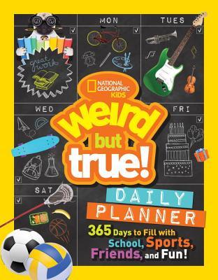
Weird But True! Daily Planner:
365 Days to Fill with School, Sports, Friends, and Fun!
Published June 13, 2017
While you're purchasing all those much needed supplies, don't forget about a planner to keep your kids motivated and on track! National Geographic Kids has put together a fantastic daily planner filled with tons of Weird But True style facts on every page to keep children learning something new every day.

The formatting of this spiral-bound planner has four days per spread. I'm personally used to planners with an entire week on one spread but I like that this planner gives you plenty of space to write down everything you need for each day. There's enough room to write down something for each school subject and more!
Something I especially like is that this planner is not limited to one specific year. So if you forget to use it this year, you can simply wait and use it next year instead!
 As shown on the right, each day of the year allows you to circle which particular day of the week it is. This in particular is perfect for me because I plan on homeschooling my little one next year and will need to keep track of our activities, field trips, etc. If this had been a strictly 2017-2018 planner I wouldn't have been able to use it as much as I would have liked.
This planner runs from August 1st to July 31st so it's perfect for schooling!


This planner runs from August 1st to July 31st so it's perfect for schooling!

There are several useful spreads in the very back of this planner to help your child with their homework. There's a world map and useful tips on how to read latitude and longitude lines as well as scale and direction. There's information on how to do proper research and how to write a report but that's not all. There are useful charts as well!
United States Atlas
Fifth Edition
Published on July 11, 2017
Goodreads | Amazon | B&N
*National Geographic Store*
Fifth Edition
Published on July 11, 2017
Goodreads | Amazon | B&N
*National Geographic Store*
Anyone wanting to learn more about the geography of the United States should definitely turn to this amazing atlas!
This book is incredibly easy to use with sections covering states in the different regions of our country, including the island territories.
 Each state has a fact box that includes basic information as well as some Geo Whiz facts. There are also photos that cover some of the interesting places or things in that state.
Each map is covered in symbols to represent physical, political, and economic features. Every state page has a symbol key so you don't have to constantly flip back to the beginning of the book to figure out what one particular symbol means.
 In addition to each state, there are plenty of maps covering the United States as a whole. Some show the physical aspects of our country's mountain ranges, environmental changes, natural hazards such as earthquakes and hurricanes, population growth, and more.
We will definitely get plenty of use out of this as we learn about our country and it's geography and plan our cross-country vacations in the future.
This book is incredibly easy to use with sections covering states in the different regions of our country, including the island territories.

Each map is covered in symbols to represent physical, political, and economic features. Every state page has a symbol key so you don't have to constantly flip back to the beginning of the book to figure out what one particular symbol means.

We will definitely get plenty of use out of this as we learn about our country and it's geography and plan our cross-country vacations in the future.
Many, many thanks to Media Masters for the chance to use these in our future homeschooling endeavors!
No comments:
Post a Comment